
Artwork offers snapshot in time
By Robert Cloud
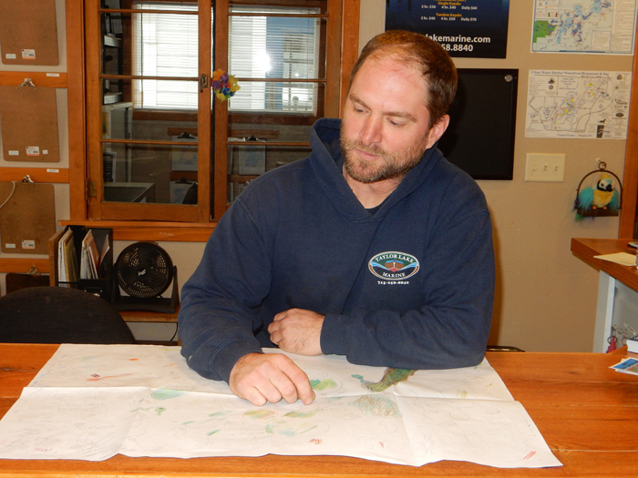
Keith Prust estimates he spent more than 360 hours to create a cartoon map of the Chain O’ Lakes.
“I’m not super artistic, so I did a lot of erasing,” Taylor said.
Prust, the owner of Taylor Lake Marine since the fall of 2011, said he started working on the map in late November 2015 and finished it in March.
“It was my winter project,” he said.
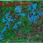
He was inspired by a map of the Chain created in 1986 by artist Craig Miller for the Waupaca Buyers’ Guide.
“I like the old one because it’s a look back on the history of the Chain,” Prust said. “You can see what businesses were here 30 years ago.”
Robert Cloud Photo
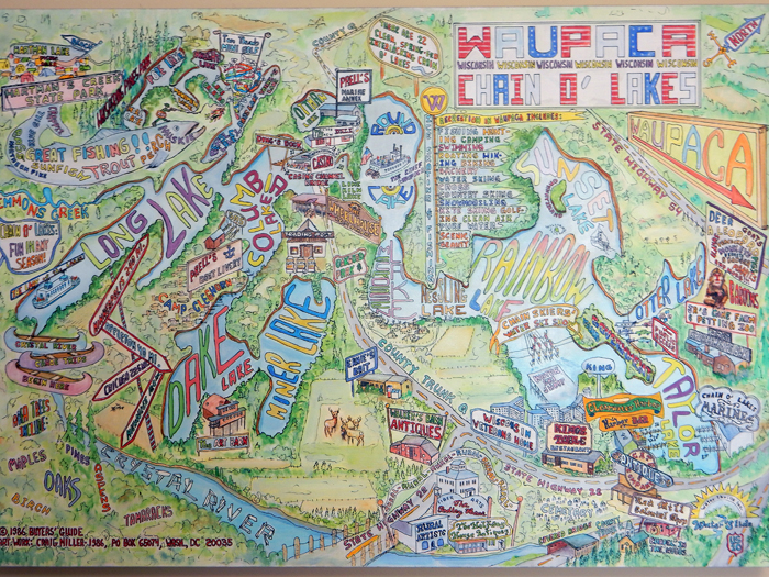
While similar, Prust’s map has more detail than the older map, more businesses are featured and the colors are darker.
Dozens of shops, restaurants and attractions around the Chain are shown in tiny detail on the map. There are also more than a dozen flags.
Although the map is an accurate depiction of the lakes, Prust adjusted the scale to show outlying areas.
In addition to such Chain landmarks as the Wheelhouse, Chief Waupaca, Harbor Bar, King’s Table and the Wisconsin Veterans Home, the map also includes the historic village of Rural, Walker’s Barn, the Red Mill and Hartman Creek State Park.
“I included Bonnie’s Bloomers, even though it isn’t up yet,” Prust said, regarding a new business slated to open later this spring.
Prust said he drove around the Chain and shot photos of some of the stores, while others he was able to rely on the street views from Google Maps.
“It’s important to me to be as accurate as possible,” he said.
Prust started by drawing free-hand maps of the lakes themselves, using pencils and erasers.
“I wanted the lakes to look as accurate as I could,” he said.
Prust started with a 13-by-11 sheet of paper, then used larger sheets of paper in order to provide more detail.
Robert Cloud Photo
After drawing the details around the lakes, Prust began coloring the drawing. He used color pencils.
“With color, I started to get to the point of no return because there was no more erasing,” Prust said.
He started by using light colors, then made the colors darker as he became more confident with his work.
Over the course of the project, Prust used eight pencils, seven erasers, 12 color pencils and four sharpeners.
When he was finished, Prust took his drawing to Office Outfitters where the map was printed in sizes of 13-by-19 inches, 20-by 30 inches and 24-by-36 inches. Prices range from $40 to $80. Framed maps are also available for an additional charge.
The maps may be purchased at Taylor Lake Marine, located at N2757 County Trunk QQ, Waupaca.